National Atlas &
Thematic Mapping Organisation (NATMO), under Ministry of Science & Technology, is organising 3 days 40th INCA International Congress from 10th February, 2021 in Kolkata. keeping in view the pandemic situations, this Congress is being held both in physical and virtual mode, keeping in view the pandemic situations.
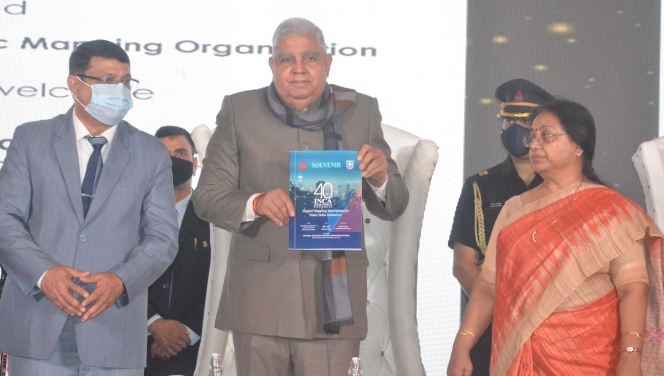
Inaugurating the congress, Governor of West Bengal Sri Jagdeep Dhankar praised the various activities taken by NATMO. He highlighted various activities taken for differently abled people. Indian National Cartographic Association (INCA), the only professional body of the cartographers and geo-spatial technologists, was founded on 7th August, 1979 at Hyderabad. It has become one of the biggest organizations of its kind in the world.

Governor of West Bengal Sri Jagdeep Dhankar inaugurating 40th INCA International Congress in Kolkata
The focal theme of 40th INCA International Congress is ‘Digital Mapping Innovations in Make India Initiatives’. About 500 experts from all over the country as well as from abroad are participating in this Congress to deliver their research-oriented findings on the focal theme.
The integration of Science, Technology and Innovation goals into national policies helps achieve sustained economic and social development. Indian decision makers, to escalate their focus on harnessing technology in various sectors, has made a clarion call to the stakeholders to pour in innovative ideas on crucial issues and segments like healthcare, food security, education and supply chain in the entire manufacturing space. With the help of Digital mapping innovations like ‘Drone’, ‘Artificial Intelligence’ now large-scale maps are able to provide more accuracy (up to 10 cm) which means that two pixel in the map will represent five cm on the ground. Such maps will help the administrators and planners for ground utility projects.
Dr. Tapati Banerjee, Director, NATMO and the President, INCA, presided over the inaugural programme. She said, “Cartography or Science of map making is as old as human civilization and it has been playing important role in the activities of mankind from the very beginning of the civilization. Cartography, like architecture, is the art, science and technology of map production and reproduction. It is one of the media of communication in the nature of graphicacy. It is a representation of any segment of spatial reality with a view to communicate and message most effectively.”
The Surveyor General of India and the Director General of Geological Survey of India Sri Nabin Tomar said that from the ancient time cartographers are making the maps which helps traveller and excavation of minerals. But now their role is quite wide, they are also helping to chalk out the development plans.